FLIGHT
TRACKER
Flight tracker – Flight radar military and civil aviation
You want to follow the vacation flight of your loved ones live on the flight radar? Or find out the destination of the aircraft that is flying overhead? With our flight radar you can follow the worldwide air traffic in real time. And become a flight tracker in no time at all. The radar shows you civil, military and small aircraft (including gliders) on a map in Germany, Austria, Switzerland and other countries. In addition, the flight radar shows you airports and a corresponding flight plan with takeoffs and landings.
Flight tracker military
The military flight radar shows you airplanes, helicopters and airports. In addition to military aircraft, civil aircraft and helicopters are also displayed. Discover now the aircraft movements in the sky:
Now let’s see how exactly the flight tracker works and can be used by you:
Use your mouse to move the map until the aircraft is in the upper map area. Now you should be able to click it and see the info. Use the + and – buttons to zoom in or out on the map
Alternatively, you can use your mouse pointer (smartphone: finger) to navigate on the map and use the mouse wheel to change the zoom.
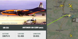
Using the radar, you can click and track different flights. You can view the previous flight route and see information about the altitude, speed, departure and arrival location
If there are any problems with the operation or the radar cannot be displayed completely, in most cases it helps to simply reload our page.
Tips for aspiring flight trackers – Track air traffic live and in real time

206.000 flights in the sky – per day! Although there are not so many aircraft in the sky every day, at peak times it can get crowded in the skies above. These flight movements do not include military aircraft. These account for a rather small share of air traffic. On average, just under 42 million flights take place each year. The trend is upward. So as a flight tracker you get your money’s worth.
With our real-time flight radar, you can now follow these flights live and retrieve interesting data about them. On average, commercial airliners move at an altitude of 11 kilometers and fly at just under 900 km/h towards their destination airport. Military jets can travel faster than that: Their top speeds can be twice the speed of sound (i.e. just under 2,500 km/h). They often fly above the airspaces of commercial aircraft at altitudes of up to 14 kilometers.
By the way, you can see the planes that are displayed to you in the radar flying in the sky. The prerequisite for this is in most cases that the sky is cloudless. Just take a quick look at our Cloud radar.
How do I spot military aircraft on airborne radar?

The display of military transport aircraft and helicopters differs significantly from the display of civilian transport aircraft and helicopters. However, you unmask the military plane or helicopter when you click on the plane/helicopter icon and see the photo. Special flight numbers and call signs such as VIRUS, PANTER, HAWK, METAL, STONE, RRR, MC, LION, PITT, USAF or BAF also indicate a military aircraft.
A flight radar works like this: Any aircraft you see on airborne radar carries a system that collects data at very short time intervals. This data can be the exact GPS position, the speed, the altitude or even the flight direction. This data is now sent out by transponder from the aircraft and received on the ground by a receiving station.
The evaluation of these data takes place in the flight tracker in real time. This allows you to follow all flight movements on the screen at the same time. By the way, experts call this tracking method ADS-B.
Which areas and countries does the flight radar cover?
In principle, flight tracking covers all countries that offer suitable radar positioning that is freely accessible to the flight radar. So, as a flight tracker, you can use the radar anywhere in the world. Only over the oceans it becomes difficult. Since radar coverage is often not available there, you will not be able to find flights far over the ocean. But if the planes are still near the coast, they are usually still detected by radar.
In the meantime the airplanes are also tracked via a Satellite tracked. As a result, the planes can also be tracked over the ocean if they are far away from the coast.
Combine flight tracking!
The Weather plays a very important role in aviation. We have also recognized this. In addition to our flight tracker, you will also find other radars such as the Thunderstorm radar or the Thunderstorm radar. For example, if you see a storm coming up, you can also see in the flight radar that airplanes avoid this storm or fly to other airports. Often this results in curious flight paths, which you can see in the flight tracker radar!
Questions and answers about the flight radar
How does an airborne radar work?
To understand how an airborne radar works, we need to briefly look at the different radar models. In aviation, the primary radar and the secondary radar play the crucial role. The primary radar emits radar radiation all around, which is reflected by objects in the air. These objects can be airplanes, helicopters, gliders, balloons, but also animals such as birds or even swarms of large insects. For a flight tracker, this primary radar would quickly cause confusion. For this reason, there is also the secondary radar.
This not only obtains its data from radar radiation and the resulting reflection, but also uses the aircraft’s transponder as a basis for information. This provides detailed information about the flight altitude, speed and the current course. In Germany, every aircraft that commercially transports passengers must carry a transponder. A special ADS-B system captures the transponder signals of the various aircraft worldwide and bundles them centrally. This information is then collected and displayed on the radar map. And visible to you as a flight tracker.
What does N/A mean for flight radar?
Surely you have already noticed it: You take a look at the flight tracker, see an interesting aircraft and of course want to know where the beautiful plane is flying to. But with great disillusionment you realize that the arrival point only says N/A. N/A, is that really an airport? And yes, where is it located?
Before you decide to search for a N/A airport via Google – let’s solve this mystery instead. N/A means nothing more than that the arrival airport is unknown. The reason for this is that no information about the destination airport is given via the transponder. This can be deliberately set by the pilot if, for example, he does not want any information about the flight route to come to the public.
What do blue aircraft (or aircraft with a circle) mean in aircraft radar?
When aircraft are far from a radar station, locating them with a radar on the ground can prove very difficult. This is partly because the signals from the transponder cannot be received over a long distance, even due to the curvature of the earth.
For this reason, aircraft are also received by satellites on the basis of the transponder signals since 2020. For this purpose, specially designed receivers are attached to the satellite, which can capture the signal and transmit it to the ground station in real time.
What does TWR mean on the map?
TWR is the abbreviation for the English term “Tower”, which means “airport control tower” in German. This is also shown on the map at some airports with a special symbol.
What does flight tracking cost?
The use of flight tracking is completely free of charge for you and does not involve any obligations. However, certain premium content in the flight radar (such as the display of detailed information about the aircraft) is associated with an additional charge. However, in terms of basic functionality, you will hardly be at a disadvantage with the free flight radar.
Why do airplanes suddenly disappear from the map?
Maybe this has happened to you: you are tracking a flight on the map and suddenly the aircraft disappears from the map with its icon without notice. No need to worry. In most cases, the aircraft has not landed quickly or even crashed, but the signals from the transponder were briefly interrupted. This can have various causes. For example, if the transponder is manually deactivated by the pilot. This is always the case after landing, for example. But it can also be that the power supply on board the aircraft is or was briefly disrupted. But often the aircraft reappears on the flight tracker radar after a short time. And you can continue to track the flights with peace of mind.
