

SATELLITE MAP
Satellite map – seeing and observing satellites
They surround our blue planet at speeds of up to 30,000 km/h and emerge at altitudes of up to 36,000 kilometers. Satellites have become an indispensable part of today’s world. In addition to providing all kinds of communication channels, they are also used to forecast the weather or to explore the universe. Keep an eye on them with our satellite map!
Almost 2,400 satellites are currently in the orbit. In the following, we will show you both how you can spot a satellite and what you should avoid at all costs if you want to observe a satellite. Let us start with the Starlink satellites.
How to observe the Starlink satellites?
Update: since August 2020, at the request of many astronomers, the new Starlinks have been equipped with a sun shield to minimize light reflections. This means that since then, the Starlinks have not been as easy to observe with the naked eye.
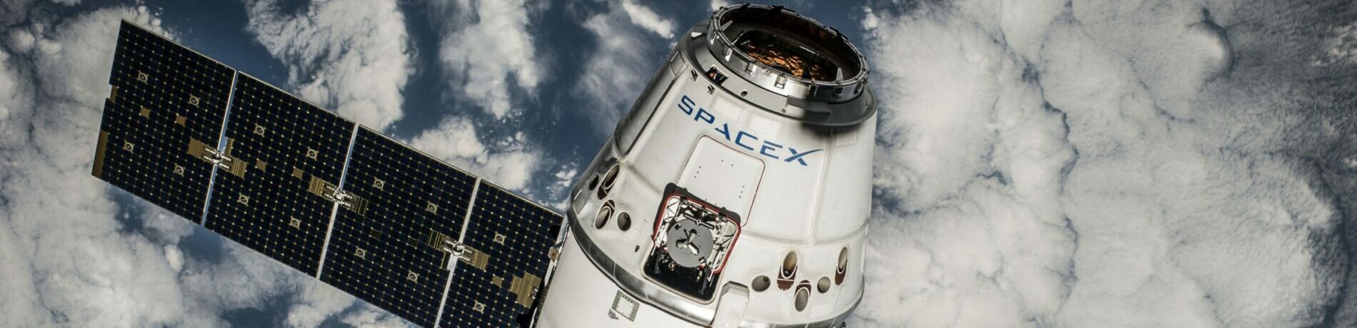
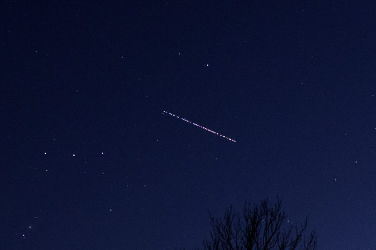
Over time, an increasing number of Starlink satellites become visible above the USA. These satellites are launched into space by the US company SpaceX. The special thing about this is that one rocket carries up to 60 Starlink satellites into Earth orbit at the same time.
As a result, you can see the satellites flying by like a string of pearls at certain times of the night. A truly exceptional view! The objective of the Starlink satellites is to provide fast broadband Internet coverage even in remote regions.
To achieve this, SpaceX owner Elon Musk wants to launch up to 12,000 Starlink satellites into orbit
LIVE satellite radar for SpaceX’s Starlink satellites
Starlink 24
Can you see satellites at night?
Yes, principally you can see satellites flying in the night sky every night. The prerequisite is that the sky is cloudless and the clear view is not disturbed by (high) fog.
Satellites themselves are usually not illuminated. They thus differ from other flying objects such as airplanes or helicopters in the night sky, which are equipped with strobe lights or position lights. An exception is the ISS, which is illuminated. However, one would not be able to perceive the illumination of the space station with the eye to Earth anyway. The distance is simply too long for that.
Satellites only become visible when their sun sails reflect the light of the sun and throw it back to the earth. When it is dark on Earth, but the satellite is still flying in the sunlight, you will be able to detect a satellite best.
When and where are satellites visible?

It does not matter whether you are in the United States, South America or any other country: Satellites only become visible when they reflect sunlight to earth. This is mostly the case until 2 hours after sunset or before sunset. Outside this period, you will not be able to see satellites.
There are two major trajectories used by satellites: Either satellites move in a polar orbit (i.e. from north to south or vice versa) or fly from west to east. Since the Earth rotates from west to east, you will not see a satellite flying from east to west. This is purely for economic reasons: If you wanted to launch a satellite into an east-west orbit using a rocket, you would need significantly more fuel for the transport, since you would have to “fight” the rotation of the Earth, so to speak.
Is it possible to see the ISS?
The ISS is easily visible to you as an observer with the naked eye. At times, the space station is much brighter than most of the stars surrounding it in the night sky.
Seeing the ISS live
When will the ISS space station be visible to you? Find out now with the LIVE satellite radar for the ISS. It will show you the current position of the ISS and its trajectory.
On the satellite map, you can see the current position and the trajectory of the satellite. Below the satellite map, the next visible overflights for your current position are displayed in the blue infobox:
See the ISS:
See the TERRA Satellite:
START AZIMUTH: Here you are shown on which day and at what time the visible overflight starts. Moreover, you learn in which direction the overflight will start. This is indicated by a clockwise number of degrees. The direction north is described by 0° or 360°, east by 90°, south by 180°, and west by 270°. Example: A degree of 45° corresponds to a northeastern viewing direction.
MAX ELEVATION: This tells you in degrees at what altitude a satellite is passing. The maximum elevation can be 90°, which would represent a flyover directly above you. Conversely, a low value such as 10° means that the satellite is only visible just above the horizon.
END AZIMUTH: Corresponding to START AZIMUTH, here you are informed where (in degrees) and when exactly the visible overflight of the satellite ends.
TOTAL DURATION: This is how long the satellite is visible to you in total during its overflight.
No visible upcoming passes: This means that there will be no visible overflights of this satellite in your region soon.
See the METOP-B:
See the NOAA 19 Satellite:
Observing Iridium satellites with the satellite radar
Iridium satellites are particularly interesting for observation in the night sky. They are also called iridium flares due to their rapidly appearing and quickly fading luminosity. This glow can be attributed to the extremely smooth solar mirrors of these communication satellites. Below you can find the LIVE location for some Iridium satellites: